|
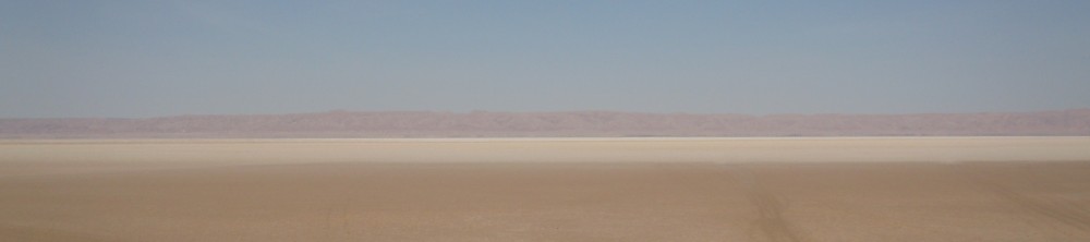
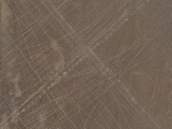
A thorough scan of the Chott el-Djerid area by analyzing satellite images led to the discovery that there existed a close meshed network of well-marked paths in Chott el-Djerid. Due to this research more than 40 paths could be discerned, exactly there are 45. In fact, we counted just these paths which are clearly discernable. So the total number of routes might be higher. Actually, the old name of this area »Lake of Marks« is confirmed by this evidence. Already the 18th century traveler Thomas Shaw cited this name referring to Chott el-Djerid by translating the local name. Arabic sources also call the Chott »Sebkha el Oueda« because of the palm trunks which are used for path signs. In fact, the extent of this systematically designed road network was not revealed up till now. The large amount of marked paths is amazing because in tradition there are no hints towards this. Arabic as well as European travel reports just refer to one safe well-marked path across the Chott el-Djerid and mention a place with an old well as intermediate stop. The more it is stressed that a local guide is needed for the crossing. This safe way runs from Degache/Kriz north of the Chott to the Nefzaoua in the south. This path is identical with the today's tarmac main road.
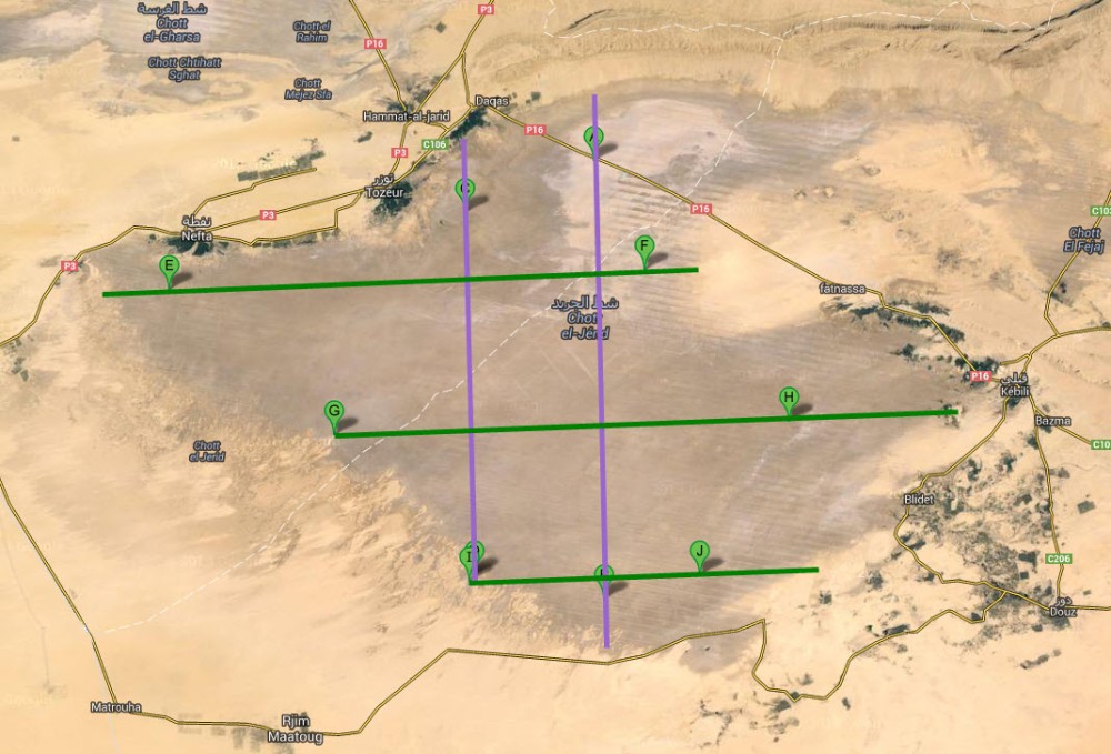
By thoroughly analyzing the satellite images a great number of marked roads could be located which are running parallel and perpendicular.
|
North-south east-west routes |
|
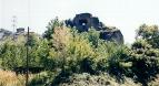
The first type is characterized by path signs which are formed by stone monuments. These appear in different sizes. There are simple ones, just consisting of one boulder, and huge constructions consisting of up to 6 boulders. Some monuments are conspicuous because of their design. On the following picture you see a boulder formed like a heart. |
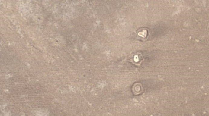
Stone monument consisting of three extraordinarily shaped boulders |
|
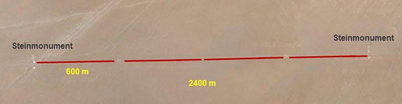
The distance between the path signs is standardized, it is normally 600 meters. Also the sequence of the path signs is standardized with regard to their size, a bigger monument is followed by 3 smaller ones, mostly simple boulders. The distance between the path signs is 600 meters, therefore the space between the bigger monuments is 2400 meters (4 intervals, each 600 m). |
Design of the marked route |
|
This path system consisting of stone monuments and longer spaces is orientated in north-south as well as in east-west direction. This road system only has few paths. There are two in north-south direction and three in east-west direction. One of the north-south routes crosses the Chott el-Djerid at its widest stretch. |
|
* * * |
|
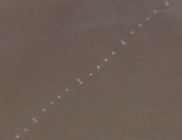
The second path system comprises a very close meshed network of marked routes. Paths orientated in northwest-southeast direction are crossed perpendicularly by paths which run in southwest-northeast direction. |

Close meshed network of marked routes |
|
The parallel paths are relatively close to each other, therefore there are many ones. Their construction is quite similar, so it is obvious that all these ways are of same origin. In contrast to the paths of first type the path signs are made of palm tree trunks which had been piled into the soil of Chott el-Djerid in a rather small distance from each other. Also in this case there is an exact sequence of marks. There are three different types. |
|
In many cases the marking is this way: A palm tree pair is followed by four single trunks and a palm tree pair again. The distance is standardized, it is about 50 meters. |
Common type of marking |
|
The second type is a double line of palm tree trunks appearing like an alley. This labor-intensive technique might have been reserved for important paths. |
Double line marking |
|
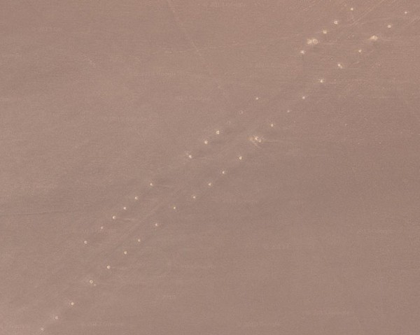
The third method of marking was by single palm tree trunks. In this case the space between is little, it is from 20 to 25 meters. |
Crossing of two routes with single palm tree marking |
|
It seems incomprehensible why that many marked paths were necessary, the more so as that many markings certainly demanded a lot of effort and resources. Amazingly, in the center of the Chott el-Djerid there are the most elaborate paths. They are like measured parcels of land. It seems rather unexplainable why they are in the most inaccessible part of Chott el-Djerid - maybe because the risk to lose the way was very high quite there. Many parallel and perpendicular paths traverse the Chott el-Djerid plain that it looks like a checked pattern. The uniformity and precision indicate that a well-thought conception must stand behind it. To determine the age of this marked path network is not an easy task. Neither in the ancient, nor in the Arabic or modern sources there are any hints towards this close meshed network of marked paths. There is only the notice that the Chott el-Djerid was called »Lake of Marks« but there is not any clue that there exists a network of that many paths. Actually, the reports on the Chott crossings always describe the same route which is identical with the today's main road. Concerning design and technique of the path system it is clear that there are two different types. The path system consisting of stone monuments looks much more archaic and therefore must be older. The exact orientation hints to a developed technique. The north-south east-west crossing paths remind at the structure of Roman newly constructed cities with their exact principal axis, Cardo and Decumanus. The multitude of paths demanded clever logistics and it certainly took a longer period to construct such a complex road system. In the Arabic sources there is no indication of such undertaking, in contrary, the travelers show a strong fear of this area, so it is rather improbable that it happened in the Middle Ages. However it seems quite possible that the Roman agrimensores (land measurers) could have done this project. The many parallel and perpendicular paths split the area of the Chott el-Djerid plain into measured parcels of land like the Romans did it when constructing a new city. Also the long peace period under the Romans - therefore plenty of time for this undertaking - would support this approach. But it is a fact that there is not any information that it had been undertaken during the Roman rule. But this should not be overestimated because the Chott el-Djerid itself had never been mentioned in Roman sources, apart the notice by Orosius about a »lacus salinarum« (salt lake) in this region. In fact, there are some clues that the marked path network might be much older. The path signs in the shape of stone monuments appear very archaic in their design as well as in their appearance. Therefore it doesn't seem improbable that it might be pre-Roman. Maybe it is prehistoric and can be connected with a people who lived at Lake Tritonis about 2500 years ago as described by the Greek historian Herodotus? |
Updated: April 26, 2024
Diese Seite gibt es auch auf deutsch.
|
|
|
|
|
|

|

|
Pics and Books *** Our Projects *** About Us Copyright © 1997-2024 Amazon Research Center |
|